
- Zhangjiajie National Forest Park: A Gem of China VIOLAAA Dec 25, 2025 23:11
- Everyone told me Beijing was ludicrously expensive and crowded, It wasn't. STEVENS May 13, 2019 23:02
- Five Ways to Travel China on a Budget ANGEL2017 Aug 24, 2017 14:18

Yellow Mountain III: Descending the Western Steps
- Views: 9374
- |Vote: 2 0
- |Add to Favorites
- |Recommend to Friends
New Year’s Eve 2007
At least I have a heater this evening, and the miniscule room I’m in somehow manages to accommodate 3 bunk beds, sleeping a total of 6 people. My Chinese roommates, I notice, have all opted for the same meal as I, and so we sit huddled around our tea eggs, pot noodles and heater.
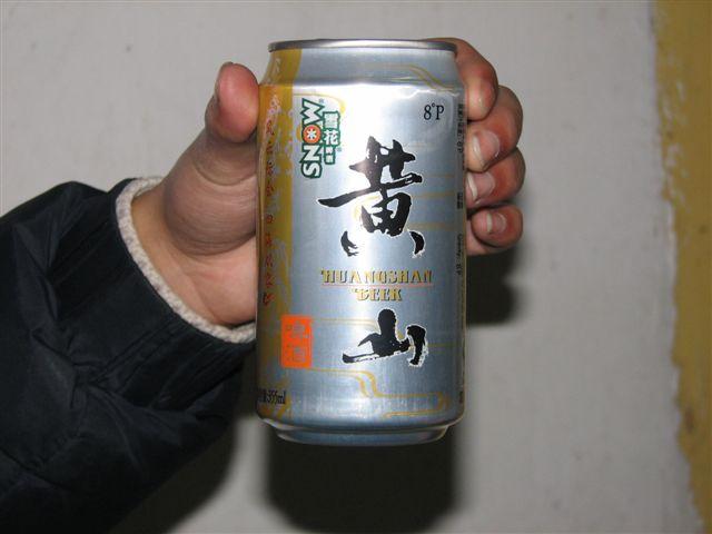
I have treated myself to a can of 黄山啤酒 (beer!) with which to celebrate the New Year, hoping that its low alcohol content will be somewhat heightened by the altitude and might help me to sleep.
At one point one of the guys in the room quite unselfconsciously announces that he snores “terribly”. This causes much laughter. I assure him it doesn’t matter as he seems concerned he will disturb me in particular.
As it happens, the beer, the altitude, last night’s lack of sleep and all that physical exertion of the last two days are no match for one Chinese guy’s snoring. In fact, it is so loud I’m surprised anyone on the mountain can get to sleep, and so I do see in the New Year in peculiar style: lying in bed and listening to his growling and spluttering...
In the dark, I try to image the noise is fireworks...
[image: yellow mountain beer]
The First Sunrise of 2008

I’m happy to be the first up, at just after 5am, and even though I’m quiet I manage to disturb the snoring man. He is lucid enough to mutter an apology before returning back to sleep.
My plan is to return to Lion Peak, a great sunset watching location, in order to watch the sunrise and it’s about an hour’s walk from my room. This morning I’m not late, and secure a position right at the front of a viewing platform. I’m the first person there.
Unfortunately it’s very windy and the position is exposed to the full force of the elements. It’s bone-numbingly cold, and I’m grateful for the steady trickle of others who fill up the platform behind me acting as a windbreak.
Other close peaks hinder the view East from Lion Peak and so this spot doesn’t provide the unequalled empty skyline and low cloud that I saw yesterday morning, nevertheless, it’s decent enough. The rocky outcrops and pine trees provide an interesting foreground, although it does take the sun much longer to actually come into view.
We bang our feet together in collective cold, the other watchers and I. We watch the sky change from night, to pale blue, to pale pink, to pale orange and it’s not until way after 7am that the first three beams of sun grip the rock with a fiery claw.
The sun has risen on 2008 and I wish the New Year a good morning.
[image: the edge of the sunrise]
Locating the Western Steps
The “Tourist Map of Huangshan” that I bought is not great. Many of the routes aren’t marked and it’s very difficult to use it as a guide to which paths you should take. So I’m quite surprised to find that the Western Steps begin behind Brightness Top, and that a second climb of this summit is required to reach the route.
I return to the 1840 metre high peak under brilliant blue skies and the morning promises another bright day with temperatures below freezing. I meet again the observatory and remember my desperate scramble for the sunrise the day before. I ask an official if I am on the right path, before continuing downwards for a while towards the Tianhai Hotel [天海宾馆].
The Tianhai hotel area is under construction but they still manage to have, here on top of Yellow Mountain, some of the best toilets I’ve ever visited in China. Warm, clean, and with a choice of Western-style or squat toilets. There was running water, wash basins, soap and even a hairdryer. I don’t usually wax lyrical about toilets (especially Chinese ones) but these are absolutely worth a paragraph of their own!
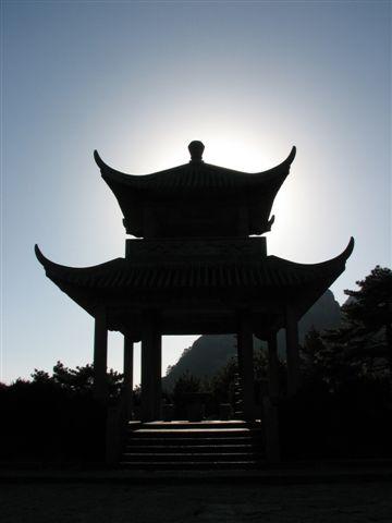
From Tianhai’s terrific loos, I head onward towards Lotus Peak passing the Haixin Pavilion [海心亭] which stands between me, Lotus Peak and the sun in glorious silhouette.
[image: the haixin pavilion in silhouette]
Turtle Peak and Alternative Routes

Heading towards Turtle Peak, I soon pick up on the Chinese from a tour guide that Lotus Peak is closed. Alternative routes are in place however and they are none the less spectacular, although my map becomes almost useless at this point as it doesn’t cover them.
I abandon my map into my backpack and decide to follow the path wherever it will take me, knowing that I will eventually get to the foot of the mountain one way or another.
Turtle Peak stands at 1710 metres and offers incredible views out over the mountain range, as well as back towards the summit where you can see the meteorological station on Brightness Top and a large, previously hidden reservoir in the valley. There are some unusual circular rock formations here, which a signpost tells me are seen as “snails” to be eaten by the “turtle”. They remind me of steamed buns and I’m suddenly very hungry.
Turtle Peak looks out over another rock formation called “Turtle Carrying Gold”. I can’t quite conjure up this image in my mind and admire the views instead.
Further along and the route splits into two with a gate blocking one of the routes. It’s obvious which way I should be going, but I can’t help following others who are sneaking under the huge gap at the bottom of the gate to explore a little further. It turns out that the gate leads to an almost vertical descent of steps that lead down between a gap in the rocks. It looks a perilous enough staircase without imagining the extra danger that the frozen ice adds to it.
A Chinese guy hovers at the top and I watch him with interest. He turns to the others and says: “I’ll let the laowai go down before me and see what happens!” This causes much mirth until I reply: “I might be a laowai, but that doesn’t mean I’m crazy!” I content myself with a photograph and am happy to take the alternative route.
[image: view westwards from turtle peak]
Meeting the Guest Welcoming Pine
The alternative route takes a lower but equally splendid path that feels as though it is cut into the rock face itself. The views are magnificent and this is by far the most interesting and picturesque section of the mountain so far. The steps drop steeply in ragged zigzags down one cliff face, only to turn and snake their way up the next. It turns out this is the beginning of the climb to Lotus Peak, but as it is closed, the steps lead downwards yet again.
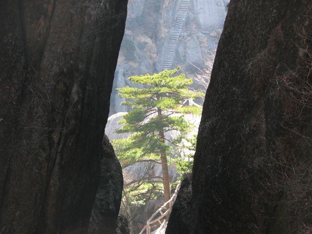
The route is at times labyrinthine, curling between narrow gaps in the rock face, or winding through caves. Every few steps opens out onto another breathtaking view or offers an interesting distraction to the fact that I am tramping in sub-zero temperatures along around 15km of concrete steps.
The pine trees are particularly impressive, with their rough stems and intricate patterns of branches. Some stand alone on distant peaks looking like bonsai trees whilst others grow in the path that has somehow been laid around them.
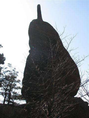
Yet another rock formation sits on the side of the path and this time is famous because it looks like a mobile phone. I can see the resemblance, but to me it looks like a pear. I wonder what it looked like before mobile phones were invented ?
It’s sometime later that I come out of the relative quietness of the pathway and onto a large terrace that is packed with people. It’s the concourse belonging to the Jade Screen Hotel which is also where the Yuping Cable Car drops off visitors who don’t want to walk the full length of the Western Steps. Not without reason does the mountain’s most famous pine tree reside here.
The Guest Welcoming Pine is, compared with other pine trees I’ve seen, rather over-rated, but one can’t fail to see where it earns its renown. Situated at the top of the Western Route it stretches its branches out over the path like long arms ready to support the weary traveller. Of course, now it is safely ensconced behind ropes and a canny photographer makes a good living charging people to get their photos taken with it.
[image: mobile phone or pear ?]
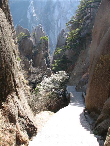
The Western Steps Have One Last Surprise
The Western Route is without doubt the most scenic of my whole trip and I’m delighted I chose to end my trip with this descent. I’m also delighted I’m not climbing up, because the Western Route is incredibly long. The non-stop (no exaggeration) steps wreak havoc with even the fittest of knees and especially after 2 days climbing on the mountain, my legs are beginning to hurt.
The route passes the closed stairway of Heavenly City Peak which reaches up to 1810 metres.
As the path descends, the trees begin and the temperature slowly increases. I can feel my feet beginning to thaw and I start to feel warm again, a novelty after 3 days on top of the mountain. The sun beams down through the trees and it feels almost like Spring.
It’s at this point that Yellow Mountain has one last surprise in store for me. Here, only a kilometre or so from the foot of the mountain, I hear a crashing in the trees to my left. I stop and take a look and there is a monkey, sat in the tree, and apparently completely oblivious to my presence. I take out my camera and get a shot before he jumps off and back into the undergrowth.
****
I reach the car-park at the bottom of the Western Steps at 2.15pm in the afternoon. It has taken me around 6 hours to make the full descent and I’m hungry and exhausted, my legs don’t even want to climb up the step onto the bus, but I make it. It seems like the first time I’ve rested in days...
As Yellow Mountain disappears into the background I reflect on the last 3 days, relaxing in the knowledge that this has been a New Year holiday to remember.
[image: pine tree & steps on the western route]
Information for Travellers
CITS WEBSITE
The official website for Yellow Mountain is actually VERY good, with everything you need to know. Here’s the link: http://www.huangshantour.com/english/
Eastern Route (Eastern Steps)
Route Length: 7.5km
Estimated time (up): 3hours (if you are reasonably fit, including photo-stops)
Difficulty: 7.5km might not sound far, but remember you are going UP steps CONTINUALLY.
Cable Car: The Yungu Cable Car [云谷索道] goes from the bottom of the Eastern Route to the summit in around 20 minutes.
MY TIP
The scenery here is OK but not “amazing” compared with the rest of Yellow Mountain. If you are on a tight time-scale and want to miss any part of it, this is the part to miss.
Western Route (Western Steps)
Route Length: 15km (variable depending on exact route)
Estimated time (down): 6 hours (including lunch and photo-stops)
Difficulty: bloody hard down, harder coming up
Cable Car: The Yuping Cable Car [玉屏索道] goes from the Jade Screen area to the bottom of the Western Route in around 20 minutes.
MY TIP
The Western Route down is spectacular and 100% more interesting than the Eastern Route. Try and go DOWN this way, I can’t imagine you’d enjoy it as much coming UP.
Northern Route (Northern Steps)
Route Length: unknown
Estimated time (up): 4 hours (according to the official)
Difficulty: unknown
Cable Car: The Taiping Cable Car [太平索道] goes from Red Cloud Station to the bottom of the Northern Route in around 20 minutes.
MY TIP
Similar to the Eastern Route in terms of scenery, if you miss this route out you won’t have missed a great deal. I did it via cable car as a side-trip.
TICKET PRICES
Please remember these are WINTER, OFF-SEASON prices, per person
Yellow Mountain Entrance Fee: 120RMB, 100RMB for students
Cable Cars: 45-55RMB one-way
Bus From Tangkou to Eastern Route Entrance: 10RMB
Bus From Tangkou to Hangzhou: 80RMB
ACCOMMODATION
Opposite Beihai Hotel
Tents: 150RMB per tent (2-person sharing)
6-bed dorm with heater: 80RMB per bed
FOOD
Before you grumble about the prices, it’s worth remembering how the food gets up the mountain. Though I’m not sure how much of the mark-up actually pays the workers who bring it!
Snack food is at least double the price you would pay from a supermarket.
Basic buffet meal at Beihai Hotel: 100RMB per person
From the stores:
Pot noodles: 10-15RMB a pot (+ free hot water)
Hot Milk Tea: 10RMB a cup (+ free hot water)
Tea Eggs (eggs boiled in tea): 2.5RMB each
Red Wine: 120RMB a bottle
Beer: 10RMB upwards per can/bottle
Biscuits: 10RMB per packet
MY TIP
If you have space, take light snacks with you: nuts, raisins and chocolate are especially good!
WEATHER
Check out the weather before you go from the internet.
There was no snow when I was there.
Day and night time temperatures on the summit are below zero at this time of year.
AREA CLOSURES: WINTER
Be aware that from November to March (depending on the weather) various areas around Yellow Mountain are closed because of dangerous conditions due to ice and snow.
The MAIN areas are:
1. The West Grand Canyon Scenic Area
2. Lotus Peak
3. Heavenly City Peak
[image: looking down the western steps]
1.
Dec 4, 2010 03:23 Reply
SUEKOH said:
tks for yr comprehensive article on hungshan. as i am going there may be next yr 2011. at least thats cable car up , and to think trekking 6 hrs for 15 km and that down hill trek is no jokes at all.