Recommended Reviews
- Getting around Lijiang. Dont stay in the Old Towns more than 2 days, there is nothing to do. KRISS Oct 9, 2013 05:46
- 2013 Beijing Temple Fair BENNYLAU Feb 26, 2013 03:29
- Malaysian traveling from KUL - LAX vis Shanghai PVG ZATI_DY Jan 3, 2013 20:15
Conquering Mt. Taibai with my husband Tony --- II
- Views: 3737
- |Vote: 0 0
- |Add to Favorites
- |Recommend to Friends
July 27
We got up very early and left the hotel at 06:00. 1 hour and 6 minutes later we reache Xian and then kept driving to Baoji. 1 hour later, we saw the blue board with “Exit here if you want to go to Mt. Taibai”. I was excited. Then we drove about 30 minutes and entered Tangyu valley. At 08:50, we arrived at the entrance to the Mt. Taibai Forest Park. Tony paid CNY 140 for the entrance fees and CNY 30 for parking fee. Then we drove through the entrance gate and arrived at the Xiaban Temple Cable Car Terminal at 12:00.
Frankly speaking, the mountain road was narrow and twisted. I was a bit afraid and asked Tony to drive. Tony must be a bit worried too. He didn’t say a word when he drove. Anyway, we arrived at the cable car terminal alive. Tony and I discussed for a second and decided to take the cable car to save our energy for climbing the summit of the mountain.
The cable car stopped after 15 minutes and then we got out and started climbing. My legs couldn’t move when we reached Shangban Temple. I told Tony that there must be griddlecakes because I smelled them. Tony said “You must be very hungry”. Yes, I was starving because I didn’t have lunch yet. We asked the peasant how much a bowl of instant noodles cost. He said “10 yuan”. It was too expensive. Thus, we bought two griddle cakes and an egg. They cost us CNY 11.
Our first goal was to reach “Tian Yuan Di Fang (Round Sky and Square Earth)” regarded as the boundary of the northern and southern slopes of the Qinling Mountain. It is just 3511 meters above sea level. The perpendicular height from Shangban Temple to Tian Yuan Di Fang is just 311 meters. However, many people fail to reach Tian Yuan Di Fang. Why? The steps are steep and they can’t finish 311 meters long trip above sea level.
I told Tony that we couldn’t give up like other travelers. Tony nodded his head and said “Yes”. But I stopped again after several minutes. I felt too tired to move my steps. Tony shouted “Come on! If you stop here, you will miss the opportunity to appreciate the wonderful scenery on the summit”. I knew he tried to encourage me. So I stood up and stepped out to continue our trip. We passed by Bai Xian Tai (Immortal Worshipping Platform) and finally arrived at Tian Yuan Di Fang at 13:50.
PS: Bai Xian Tai is 3300 meters above sea level. Many tourists come here and take some photos. Then they head back to the Shangban Temple to take cable car back to the foot of the Mt. Taibai. They can’t make it to the Tian Yuan Di Fang.
In fact, Tian Yuan Di Fang is not the real boundary that divides Qinling Mountain into northern and southern slopes. where is the real boundary? Ba Xian Tai, the main peak of the Mt. Taibai. Then why is Tian Yuan Di Fang named as the boundary? Because most tourists can’t reach the Ba Xian Tai. In order not disappoint them, the boundary is moved from Ba Xian Tai to Tian Yuan Di Fang.
Tony and I took a rest at Tian Yuan Di Fang. He noticed that I was already exhausted. So he asked if I wanted to go on with our trip. Honestly, I planned to give up. But I knew that my husband would regret if he couldn’t reach Ba Xian Tai. I told him that I needed time to think. Tony said nothing but sat beside me for 10 minutes until I told him I didn’t want to let you down. He doubted and said “Are you serious?” I said “Yes”. Then we stood up and kept climbing.
We reached Xiaowengong Temple at 14:30. Here we paid CNY 40 as admission fees to the Mt.Taibai Natural Reserve. A man told us we had to fill two forms and exchange cellphone numbers. He added that Xiaowengong Temple was the entrance to the Mt. Taibai Natural Reserve and that we could contact them if we were in trouble. Tony giggled and asked him what trouble we might meet. “Be serious! Haven’t you read the forms carefully? You have to be responsible for your safety because you are going to the deep mountain areas.” Tony realized that the man was serious and apologized to him. Then we left Xiaowengong Temple.
When I told Tony I wanted to keep climbing, I already realized that the road ahead would be full of hardships. But the situation was worse than I thought. In order to get to our next stop (Dawengong Temple), we had to conquer three steep slopes formed in the fourth glacial stage of the Pleistocene Epoch. Tony was excited and told me that he never saw this before. Whilst regretted coming here.
Seriously, it was very dangerous to climb the slopes because there were just narrow paths. I lowered my head and stared at my feet with every pace I took because I was afraid of falling. What’s worse, my altitude sickness was almost killing me. I had to stop for five minutes after I took 20 steps. I guess Tony was tired too because he didn’t walk as fast as before. Finally, we conquered the first slope after 50 minutes. Holy Shit! The second slope was longer and steep than the first one. I sat down and told Tony that I couldn’t go any further. Tony said we couldn’t stop here. I understood that he was right. We wouldn’t make it to catch the last cable car even though we got back immediately.
What could I do? The only thing I could do was to climb, climb and climb. Eventually, we conquered all the three slopes in 2.5 hours. Looking back at paths we crossed, I felt very proud of myself. Tony also praised that I was a heroine.
Suddenly, I saw a white and blue house. Tony told me that it was probably the reception station near the Dawengong Temple. I jumped and told Tony that we made it. Tony smiled and said “Yes”. When we arrived at reception station, we were told that the night shut down at 20:00 and we could get to Daye Lake within 3 hours. Tony told me that we could reach Ba Xian Tai in 40 minutes from the Daye Lake. I planned to stay here for a night when I climbed the three slopes. But I changed my mind. I wanted to see the Daye Lake with Tony. Then Tony, I and two heavers stepped out of the reception station toward the Daye Lake.
One heaver carried a gasholder and the other held instant noodles and purified water on his back. Tony and I chatted with them. They told us they suffered from the altitude sickness too. I was shocked. They burdened gasholder, instant noodles and purified water to climb the mountain even though they suffered from altitude sickness. Very brave!
The heavers told us we had to climb over Bagong Mountain before getting to Daye Lake. I asked them why the mountain was named Bagong. They said there were eight ridges on the mountain. OMG! I had to climb eight ridges after passing three steep slopes. Tony comforted me and said he believed that I could get to the Daye Lake. But I doubted myself. My hands were swollen and my head was going to explode. I told Tony that I wanted to sleep for a while. Tony frightened me that I wouldn’t awake if I fell into sleep. I shouted at him “I am sick! I am sick!” He calmed me down and handed me a bottle of water. Then I felt much better after drinking some water. But I didn’t sweat and had no impulse to pee even though I drank almost a bottle of water.
Tony and I finally made it to the reception station near the Daye Lake in two hours. The two heavers already got here. They told us they just arrived 10 minutes earlier than us. Except the heavers and us, there were a parent with her two daughters, two couples and three students.
Seeing the Daye Lake, I firmly believed that it was definitely worth a visit. The lake was round and its water looked deep blue and quiet. But you couldn’t see its bottom. I thought it must be very deep.
We got up very early and left the hotel at 06:00. 1 hour and 6 minutes later we reache Xian and then kept driving to Baoji. 1 hour later, we saw the blue board with “Exit here if you want to go to Mt. Taibai”. I was excited. Then we drove about 30 minutes and entered Tangyu valley. At 08:50, we arrived at the entrance to the Mt. Taibai Forest Park. Tony paid CNY 140 for the entrance fees and CNY 30 for parking fee. Then we drove through the entrance gate and arrived at the Xiaban Temple Cable Car Terminal at 12:00.
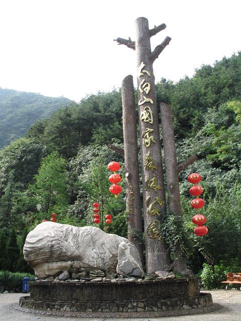 |
| Entrance to the Mt. Taibai Forest Park |
Frankly speaking, the mountain road was narrow and twisted. I was a bit afraid and asked Tony to drive. Tony must be a bit worried too. He didn’t say a word when he drove. Anyway, we arrived at the cable car terminal alive. Tony and I discussed for a second and decided to take the cable car to save our energy for climbing the summit of the mountain.
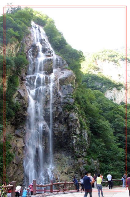 |
| Lotus Peak Waterfall |
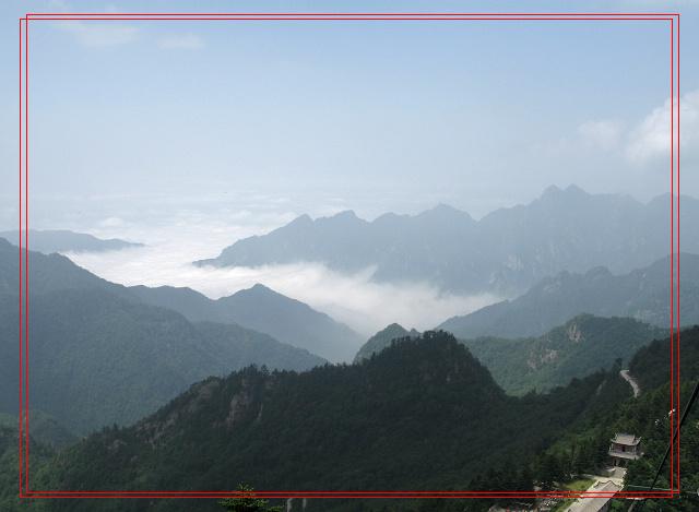 |
| Cloud Sea 1 |
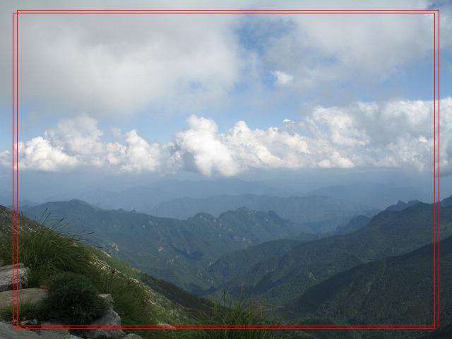 |
| Cloud Sea 2 |
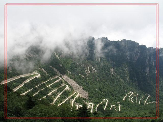 |
| Wandering mountain roads |
The cable car stopped after 15 minutes and then we got out and started climbing. My legs couldn’t move when we reached Shangban Temple. I told Tony that there must be griddlecakes because I smelled them. Tony said “You must be very hungry”. Yes, I was starving because I didn’t have lunch yet. We asked the peasant how much a bowl of instant noodles cost. He said “10 yuan”. It was too expensive. Thus, we bought two griddle cakes and an egg. They cost us CNY 11.
Our first goal was to reach “Tian Yuan Di Fang (Round Sky and Square Earth)” regarded as the boundary of the northern and southern slopes of the Qinling Mountain. It is just 3511 meters above sea level. The perpendicular height from Shangban Temple to Tian Yuan Di Fang is just 311 meters. However, many people fail to reach Tian Yuan Di Fang. Why? The steps are steep and they can’t finish 311 meters long trip above sea level.
I told Tony that we couldn’t give up like other travelers. Tony nodded his head and said “Yes”. But I stopped again after several minutes. I felt too tired to move my steps. Tony shouted “Come on! If you stop here, you will miss the opportunity to appreciate the wonderful scenery on the summit”. I knew he tried to encourage me. So I stood up and stepped out to continue our trip. We passed by Bai Xian Tai (Immortal Worshipping Platform) and finally arrived at Tian Yuan Di Fang at 13:50.
PS: Bai Xian Tai is 3300 meters above sea level. Many tourists come here and take some photos. Then they head back to the Shangban Temple to take cable car back to the foot of the Mt. Taibai. They can’t make it to the Tian Yuan Di Fang.
In fact, Tian Yuan Di Fang is not the real boundary that divides Qinling Mountain into northern and southern slopes. where is the real boundary? Ba Xian Tai, the main peak of the Mt. Taibai. Then why is Tian Yuan Di Fang named as the boundary? Because most tourists can’t reach the Ba Xian Tai. In order not disappoint them, the boundary is moved from Ba Xian Tai to Tian Yuan Di Fang.
Tony and I took a rest at Tian Yuan Di Fang. He noticed that I was already exhausted. So he asked if I wanted to go on with our trip. Honestly, I planned to give up. But I knew that my husband would regret if he couldn’t reach Ba Xian Tai. I told him that I needed time to think. Tony said nothing but sat beside me for 10 minutes until I told him I didn’t want to let you down. He doubted and said “Are you serious?” I said “Yes”. Then we stood up and kept climbing.
We reached Xiaowengong Temple at 14:30. Here we paid CNY 40 as admission fees to the Mt.Taibai Natural Reserve. A man told us we had to fill two forms and exchange cellphone numbers. He added that Xiaowengong Temple was the entrance to the Mt. Taibai Natural Reserve and that we could contact them if we were in trouble. Tony giggled and asked him what trouble we might meet. “Be serious! Haven’t you read the forms carefully? You have to be responsible for your safety because you are going to the deep mountain areas.” Tony realized that the man was serious and apologized to him. Then we left Xiaowengong Temple.
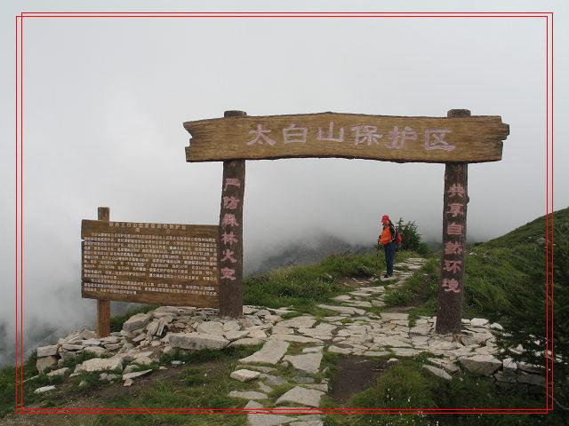 |
| Entrance to Mt. Taibai Natural Reserve |
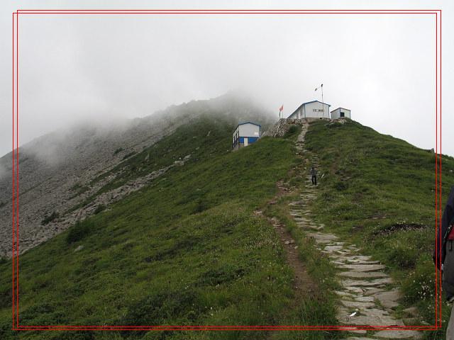 |
| Xiaowengong Temple |
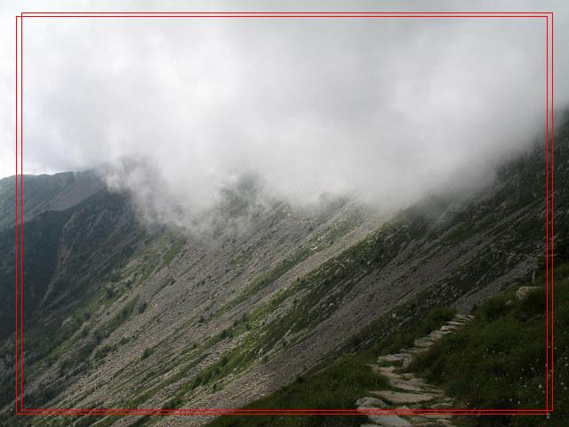 |
| A steep slope formed in the fourth glacial stage of the Pleistocene Epoch between Xiaowengong and Dawengong Temples |
When I told Tony I wanted to keep climbing, I already realized that the road ahead would be full of hardships. But the situation was worse than I thought. In order to get to our next stop (Dawengong Temple), we had to conquer three steep slopes formed in the fourth glacial stage of the Pleistocene Epoch. Tony was excited and told me that he never saw this before. Whilst regretted coming here.
Seriously, it was very dangerous to climb the slopes because there were just narrow paths. I lowered my head and stared at my feet with every pace I took because I was afraid of falling. What’s worse, my altitude sickness was almost killing me. I had to stop for five minutes after I took 20 steps. I guess Tony was tired too because he didn’t walk as fast as before. Finally, we conquered the first slope after 50 minutes. Holy Shit! The second slope was longer and steep than the first one. I sat down and told Tony that I couldn’t go any further. Tony said we couldn’t stop here. I understood that he was right. We wouldn’t make it to catch the last cable car even though we got back immediately.
What could I do? The only thing I could do was to climb, climb and climb. Eventually, we conquered all the three slopes in 2.5 hours. Looking back at paths we crossed, I felt very proud of myself. Tony also praised that I was a heroine.
Suddenly, I saw a white and blue house. Tony told me that it was probably the reception station near the Dawengong Temple. I jumped and told Tony that we made it. Tony smiled and said “Yes”. When we arrived at reception station, we were told that the night shut down at 20:00 and we could get to Daye Lake within 3 hours. Tony told me that we could reach Ba Xian Tai in 40 minutes from the Daye Lake. I planned to stay here for a night when I climbed the three slopes. But I changed my mind. I wanted to see the Daye Lake with Tony. Then Tony, I and two heavers stepped out of the reception station toward the Daye Lake.
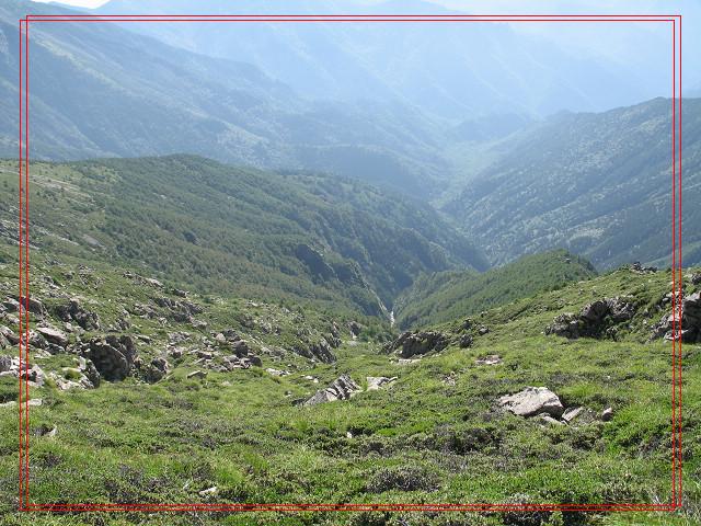 |
| The most difficult path near the Dawengong Temple |
One heaver carried a gasholder and the other held instant noodles and purified water on his back. Tony and I chatted with them. They told us they suffered from the altitude sickness too. I was shocked. They burdened gasholder, instant noodles and purified water to climb the mountain even though they suffered from altitude sickness. Very brave!
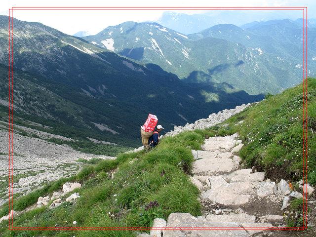 |
| Heaver with a huge bamboo bucket on his shoulders |
The heavers told us we had to climb over Bagong Mountain before getting to Daye Lake. I asked them why the mountain was named Bagong. They said there were eight ridges on the mountain. OMG! I had to climb eight ridges after passing three steep slopes. Tony comforted me and said he believed that I could get to the Daye Lake. But I doubted myself. My hands were swollen and my head was going to explode. I told Tony that I wanted to sleep for a while. Tony frightened me that I wouldn’t awake if I fell into sleep. I shouted at him “I am sick! I am sick!” He calmed me down and handed me a bottle of water. Then I felt much better after drinking some water. But I didn’t sweat and had no impulse to pee even though I drank almost a bottle of water.
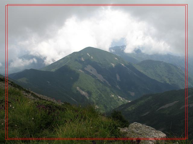 |
| Bagong Mountains |
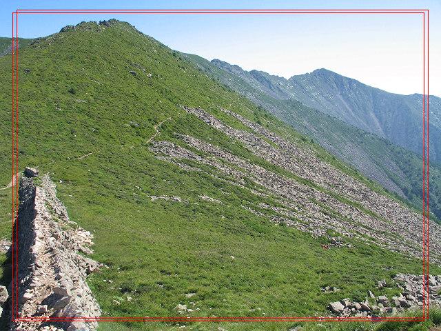 |
| Bagong Mountains 2 |
Tony and I finally made it to the reception station near the Daye Lake in two hours. The two heavers already got here. They told us they just arrived 10 minutes earlier than us. Except the heavers and us, there were a parent with her two daughters, two couples and three students.
Seeing the Daye Lake, I firmly believed that it was definitely worth a visit. The lake was round and its water looked deep blue and quiet. But you couldn’t see its bottom. I thought it must be very deep.
Comments (0)


 Copyright © 1998-2026 All rights reserved.